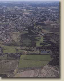
Why Hornchurch?
1915 - 1962
Since Prehistory the Thames Estuary has been a vital route
from continental Europe into the heart of Southern Britain.
In good times this has meant it has been an artery for trade;
in bad times a potential highway for would be invaders. Since
at least the period of the Dutch Wars of the 17th century
and up to the end of World War II, British defensive policies
in relation to the rest of Europe have been geared to deny
enemies from using the Thames to strike at London; the nation’s
capital and the powerhouse of Britain’s commercial and
industrial power.
Even before the outbreak of War in 1914 against the Germany
of Kaiser Wilhelm, the potential of military aviation to add
a third dimension to war on land and at sea had already been
realised. The Thames was an easy landmark to follow from the
air, by day or by night, into the heart of London and the
line of the Thames was first used thus by German raiders in
World War I. During World War II, the intensity of the aerial
attacks led to the unfortunate towns along the path of the
Thames being referred to as lying in “Bomb Alley”.
The defence of London from air attack was already being considered
in 1914 by the then War Ministry and conclusions reached as
to how it should be achieved. These conclusions were to prove
to be relevant for both World War I and World War II. The
conclusions were that the only sure way to prevent an air
attack on London was to make an aerial interception of airborne
attackers, preferably well before they made their own attacks.
To make such an interception it was appreciated that a permanent
home defence force of dedicated fighter air craft flying from
bases in a cordon across enemy aerial approach routes was
required. It was also appreciated that early warning of an
enemies approach would be required to allow effective interception.
Finally, and crucially, it was realised that the direction
of interceptions was best undertaken by a central control
which could collate the observations of an approaching raid
and so warn the relevant air fields in plenty of time to ensure
that intercepting air craft had time to reach a position and
altitude from which they could effectively attack a raider.
This doctrine was first established when raiders could only
be picked up by the Mark I eyeball or ear when crossing the
coast and when the standard aircraft of the day had a top
speed of c 90 mph and took upwards of an hour to reach their
maximum operational altitude of c 12,000’. It remained
relevant during the early years of World War II when air craft
speeds reached 300 - 400 mph, maximum altitudes c 30,000’
and enemy aircraft formations could be picked up by Radar
when massing over the French coast.
During World War I Hornchurch’s location was ideal
for an intercepting plane to reach its patrol position and
altitude to intercept raiders that were first identified by
observers on the Kent, Essex or Suffolk coasts. During World
War II, Hornchurch’s location allowed aircraft based
there to intercept raiders, over the Kent coast and to harry
them all the way to their targets and possibly, if fuel and
ammunition allowed, all the way back again.
|